.webp&w=1920&q=82)
.webp&w=1920&q=82)
.webp&w=1920&q=82)
.webp&w=1920&q=82)
.webp&w=1920&q=82)
.webp&w=1920&q=82)
.webp&w=1920&q=82)
.webp&w=1920&q=82)
.webp&w=1920&q=82)
Baía de Camamu
Costa do Dendê, on Bahia’s southern coast, in a protected system encompassing Camamu, Maraú, and Itacaré.
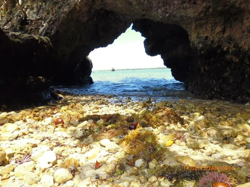
On the Costa do Dendê, Camamu Bay brings calm waters, islands, and mangroves together with villages where the boat remains part of daily life. It is a seaward gateway to Barra Grande and to restinga landscapes, reefs, and beaches.
Brazil’s third-largest bay opens across a reach about 24 km (15 mi) wide and 43 km (27 mi) deep, where fresh, brackish, and salt waters meet mangroves, remnants of the Atlantic Forest, and reefs. To travel through it is to encounter coves, islands, and Costa do Dendê communities; from Camamu’s pier, crossings depart for Barra Grande on the Maraú Peninsula. The tide sets the rhythm here: it determines the choice of outings and visits to nearby natural tide pools.
🤔 Why does it matter?
The bay reveals the Costa do Dendê beyond its beaches: this landscape safeguards mangrove ecological functions, supports the movement of coastal communities, and brings visitors closer to a town whose history begins in a Tupiniquim village. For slow travelers, it is a water route joining nature, fishing, and memory.
📍 What to see
- Islands, coves, and sandbars reshaped by the tide
- Extensive mangroves and Atlantic Forest fragments safeguarded by the environmental protection area
- Camamu’s pier, the Parish Church of Nossa Senhora da Assunção, and historic streets
- Cassange Lagoon, with a preserved stretch of restinga, in the Maraú area
- Ponta do Mutá, Tremembé, Saquaíra, and Algodões, coastal attractions listed by the state environmental agency
- Taipu de Fora natural tide pools on the Maraú Peninsula, when low tide favors pools forming among the reefs
🎒 Things to do
- Take the speedboat crossing between Camamu Pier and Barra Grande
- Arrange a boat tour of the bay’s islands, beaches, and channels
- Kayak or stand-up paddleboard only in suitable conditions and with local support
- Schedule snorkeling at Taipu de Fora around the low-tide forecast
- Walk through central Camamu before or after boarding
- Watch the late light from piers, beaches, or lookout points on the Maraú Peninsula
✨ Recommended experiences
- A half-day sea link: arrive in Camamu, explore the pier, and cross to Barra Grande with your bags ready for boarding.
- A tide-focused day: stay on the Maraú Peninsula and pair a low-tide window at Taipu de Fora with a seafood lunch.
- A nature route: hire a local operator to navigate coves and islands, keeping your distance from mangrove vegetation and returning before the weather shifts.
- A slow two- to four-day trip: use Barra Grande as your base, include the peninsula’s beaches, and save one morning for Camamu.
🍽️ Local cuisine
🎶 Soundtrack
- O Mar — Dorival Caymmi
- Refazenda — Gilberto Gil
- O Quereres — Caetano Veloso
🎭 Local culture
🌿 Nature nearby
🌎 Biomes
🏞️ Natural features
🐾 Possible animals in the area
🌱 Possible plants in the area
📅 Best time to visit
September through March tends to offer more sunny intervals for beach activities; in any month, consult the tide to plan outings on the water.
- ✅ Best time:
- September through March, when the editorial listing indicates generally more favorable weather on the Maraú Peninsula
- 🟡 Shoulder season:
- August, a transitional month that may bring fewer visitors and stronger winds
- 🔴 Less recommended:
- April through July, a period that tends to bring more rain and can hinder dirt roads and outdoor activities
- 📝 Notes:
- Rain can fall at any time of year. Natural tide pools, sandbars, and boating conditions are set by the tide and time of day, not only by the month of travel.
🧭 Getting there
🏙️ Base city: Camamu, with Barra Grande as an alternative base on the Maraú Peninsula
✈️ Airport: Ilhéus–Jorge Amado Airport, in Ilhéus
- Arrive via Ilhéus or Salvador, then travel by road to Camamu, home to the embarkation pier for the Maraú Peninsula.
- The road link to Camamu uses Bahia’s southern coastal road network; check current conditions before setting out.
- For Barra Grande, passenger speedboats leave Camamu; the trip is estimated at 30–40 min, depending on stops, the tide, and weather conditions.
- Land access to the Maraú Peninsula uses BR-030, including unpaved stretches that require particular attention after rain.
🚗 Local transportation
- Use scheduled speedboats or chartered vessels to move between Camamu, Barra Grande, and coastal settlements.
- On the Maraú Peninsula, taxis, jardineiras, and local transfers connect Barra Grande Pier with Taipu de Fora and other beaches.
- For islands and coves, arrange the route, return time, and safety gear with a local operator in advance.
ℹ️ Practical information
- 🏗️ Infraestrutura:
- Variable, with modest urban infrastructure in Camamu and a broader tourism offering in Barra Grande
- 🏨 Hospedagem:
- Camamu has guesthouses and small-scale lodging; Barra Grande offers greater variety on the Maraú Peninsula.
- 🍴 Diet:
- Restaurants, beach stalls, and guesthouses serve Bahian cooking and seafood, especially in the tourist areas of Camamu and Barra Grande.
- 🧭 Guides and agencies:
- Boat-transfer and water-tour operators are available; before booking, confirm registration, vessel details, life-saving equipment, and cancellation policy.
- 📶 Internet and signal:
- Generally available in the main towns and villages, but subject to interruptions on boat journeys and in remote stretches.
- 💰 Estimated cost:
- There is no single admission fee for the bay; transport, tours, lodging, and meals are charged separately and vary by operator, season, and itinerary.
- 📝 Notes:
- No single, stable public price list was found for all services. Check prices, schedules, and availability directly with operators on your travel date.
♿ Acessibilidade
Level: consult local operators
Access to boats usually involves piers, steps, and boarding conditions that vary with the tide and vessel. Beach areas may have soft sand and uneven footing.
- State mobility needs before booking lodging, transfers, or a boat trip.
- Confirm whether the vessel provides boarding assistance and space compatible with mobility aids.
- Choose routes with fewer boat changes and check the pier’s condition on the day of departure.
⚠️ Safety
🚨 Real risks
- Tide shifts that alter depth, sandbars, and access to natural tide pools
- Changes in weather and wind that can affect navigation
- Intense sun exposure and dehydration during sea and beach activities
- Unpaved road stretches that become more difficult in rainy periods
✅ Recommended care
- Wear a life jacket and follow crew instructions during crossings and tours.
- Consult the tide table before heading to reefs, natural tide pools, or sandbars.
- Bring sun protection, water, and a dry bag for documents and electronics.
- Choose clearly identified operators and do not accept navigation in adverse conditions.
⛔ When to avoid: Avoid boarding during weather warnings, rough seas, poor visibility, or whenever the operator reports unsafe conditions; postpone travel on muddy roads after heavy rain.
📝 Checklist — what to bring
- Identification and booking confirmations protected from water
- Sunscreen, hat and sunglasses
- Reusable water bottle
- Dry bag for phone and camera
- Sandals with good grip or footwear suitable for boarding
- Snorkel mask, if permitted on the tour
- Cash or alternative payment methods for small services
✈️ Travel tips
- Allow at least two days to combine Camamu, Barra Grande, and one peninsula beach without turning the trip into a rush.
- Plan your visit to Taipu de Fora around the low-tide time, not the sunshine forecast alone.
- If you arrive late in Camamu, confirm in advance whether a crossing will still run or consider staying overnight in town.
- Avoid driving on the Maraú Peninsula at night if you do not know the road conditions.
- Keep your distance from mangroves and leave no waste on islands, beaches, or boats.
💡 Curiosidades
- The Camamu Bay Environmental Protection Area covers 118,000 ha (292,000 acres) and was created by State Decree No. 8,175 in 2002.
- The bay measures about 24 km (15 mi) wide and 43 km (27 mi) deep, according to Bahia’s Institute of the Environment and Water Resources.
- The state environmental agency classifies it as Brazil’s third-largest bay.
- The protected boundary includes the land, waters, islands, and reefs of Camamu, Maraú, and Itacaré.
🤔 Did you know?
- The protected area brings fresh, brackish, and salt waters together in one coastal system.
- One purpose of the conservation unit is to protect native fauna and flora, with particular attention to migratory birdlife.
- Beyond serving tourists, scheduled boats also serve nearby communities such as Ilha Grande, Campinho, Taipu de Dentro, and Ilha do Sapinho.
- IBGE records submerged, dam-like structures at the entrances to Conduru and Tiriri that can impede deeper-draft vessels at low tide.
📜 History and context
Camamu’s urban core began as a Tupiniquim village recorded in 1560. The following year, the village was moved to Passagem do Macamamu and named Nossa Senhora da Assunção de Macamamu. After disputes over its administrative status, the settlement was raised to town status by Royal Charter in 1693 and became a city in 1891. Today, the bay lies within an environmental protection area established by the State of Bahia in 2002.
🌍 Global importance
No specific international designation for the bay was identified in the sources consulted. Its significance extends beyond tourism: it protects a coastal mosaic of Atlantic Forest, mangroves, waters of differing salinities, and areas used by migratory birdlife, all parts of coastal ecosystems of broad conservation value.
🗺️ Quick map (orientation)
📌 Main base: Camamu, at the municipal pier where crossings to Barra Grande are organized
🧭 Landmarks
📍 Nearby places
Pequenas descobertas
- Santuário costeiro
- A tropical bay on Bahia’s southern coast, surrounded by mangroves, islands, and fishing villages.
- Bahia
- The Brazilian state where Camamu Bay is located.
- Mangues
- Aerial roots characteristic of mangroves, supporting and oxygenating the plants.
- Bancos de areia
- Sand accumulations that may emerge at low tide, forming temporary beaches.
- Voadeira
- A light, fast boat used on rivers and in shallow coastal waters.
- Dendê
- Oil extracted from the fruit of the dendê palm, a foundation of Bahian cuisine.
- Açaí/juçara
- An Amazonian fruit popular in Bahia, also called juçara in some chilled preparations with flour.
- Mandioca
- Also known as macaxeira or aipim, cassava is a staple for flours and cakes.
- Piscinas naturais
- Pools formed behind reefs at low tide, suitable for underwater observation.
- Tábua de marés
- A table of tide times and heights for a given port or region.
- Saco estanque
- A waterproof zippered bag used to keep items dry.
- SSA
- IATA code for Salvador International Airport.
- IOS
- IATA code for Ilhéus Airport - Jorge Amado.
- Manguezais
- Coastal ecosystems that serve as fish nurseries and natural protection.
- Turismo de aventura leve
- Activities along coastal and sandy routes, supported by local guides.
- Cabotagem
- Navigation between ports in the same country, close to the coast.