.webp&w=1920&q=82)
.webp&w=1920&q=82)
.webp&w=1920&q=82)
.webp&w=1920&q=82)
.webp&w=1920&q=82)
.webp&w=1920&q=82)
.webp&w=1920&q=82)
.webp&w=1920&q=82)
.webp&w=1920&q=82)
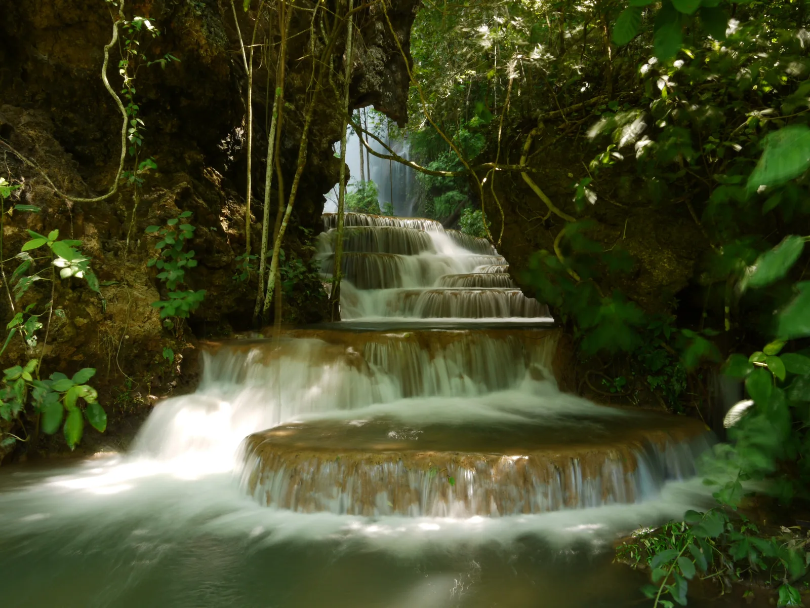
Cachoeira Boca da Onça
Boca da Onça Ecotour
On the Bodoquena/Bonito Highway, MS-178, km 96 (mi 60), in rural Bodoquena, in Serra da Bodoquena.
In Serra da Bodoquena, Cachoeira Boca da Onça brings together a waterfall, cliff faces, trails and swimming holes within a rural Bodoquena complex. The landscape makes room for thoughtful contemplation and vertical adventure on the same day.
The Boca da Onça Ecotour circuit follows the limestone landscape of the Salobra River, revealing waterfalls, natural pools and places to rest in the forest. The main waterfall drops 156 meters (512 ft); beside it, a platform allows a 90-meter (295-ft) rappel over the canyon. Guided routes range from an easy 2.1 km (1.3 mi) walk to a 6.5 km (4 mi) route, with support facilities and meals included on the trails advertised by the operator.
🤔 Why does it matter?
The attraction embodies the Bonito and Bodoquena region’s calling for organized ecotourism: water for swimming, canyon terrain, guided routes and a large-scale adventure activity. It offers a clear introduction to how Serra da Bodoquena brings together the Cerrado—the Brazilian savanna—Atlantic Forest remnants and the hospitality culture of Mato Grosso do Sul.
📍 What to see
- Cachoeira Boca da Onça, described by the operator as the state’s tallest drop, at 156 meters (512 ft)
- The Salobra River Canyon from the rappel platform
- Buraco do Macaco
- Janela para o Céu
- Boca da Onça Beach and the circuit’s natural pools
🎒 Things to do
- Hike the 4.5 km (2.8 mi) Adventure Trail, with eight waterfalls and five swimming stops
- Choose the 6.5 km (4 mi) Discovery Trail to visit 15 waterfalls and cascades
- Descend the 90-meter (295-ft) rappel when operational and weather conditions allow
- Take the 2.1 km (1.3 mi) Meia Trilha Buraco do Macaco for a shorter outing
- Enjoy the day-use facilities, with a pool, lounges, hot tub and infinity edge
✨ Recommended experiences
- A day of waterfalls: choose the Adventure Trail, stop to swim and finish with the meal included in the itinerary.
- A longer immersion: take the Discovery Trail to spend more time beside the Salobra River and reach more stretches of water.
- Adventure with a view: pair the Adventure Trail with the rappel, allowing time for the briefing, equipment and operating conditions.
- A family-paced outing: choose the Meia Trilha Buraco do Macaco, which returns to the visitor center by support vehicle and does not include the main waterfall.
🍽️ Local cuisine
🎶 Soundtrack
- Tocando em Frente — Almir Sater
- Trem do Pantanal — Paulo Simões e Geraldo Roca
🎭 Local culture
🌿 Nature nearby
🌎 Biomes
🏞️ Natural features
🐾 Possible animals in the area
🌱 Possible plants in the area
📅 Best time to visit
From May to September, especially between July and September, the drier season generally favors the trails and water visibility.
- ✅ Best time:
- July to September, when milder weather and generally firmer walking conditions coincide.
- 🟡 Shoulder season:
- May and June, when the dry season begins to set in and watercourses remain appealing.
- 🔴 Less recommended:
- October to March, because of the heat and more frequent rain.
- 📝 Notes:
- During the rainy season, water volume may rise, and activities such as the rappel depend on an operational assessment. Confirm weather conditions and operations before leaving Bonito or Bodoquena.
🧭 Getting there
🏙️ Base city: Bonito
✈️ Airport: Bonito Regional Airport (BYO)
- From Bonito, take the road toward Bodoquena to the Bodoquena/Bonito Highway, MS-178, km 96 (mi 60).
- The visitor center is in Bodoquena; the local tourism reference indicates approximately 68 km (42 mi) from Bonito and 36 km (22 mi) from Bodoquena’s town center.
- Campo Grande International Airport (CGR) is an alternative for travelers arriving by air and continuing by road to the region.
🚗 Local transportation
- A transfer arranged with a Bonito agency avoids the need to drive after a day on the trail.
- If traveling in your own vehicle, confirm road conditions on the rural stretch and the visitor center meeting point in advance.
- On the shorter route, the return to the visitor center is by the farm’s support vehicle.
ℹ️ Practical information
- 🏗️ Infraestrutura:
- Set up for full-day guided excursions, with a visitor center and support points along the circuit.
- 🏨 Hospedagem:
- Lodging should be arranged in Bonito or Bodoquena’s town center; no overnight option at the attraction was found on the official pages consulted.
- 🍴 Diet:
- The Adventure Trail, Discovery Trail and Meia Trilha advertise breakfast and lunch as included. The visitor center also has a restaurant.
- 🧭 Guides and agencies:
- The itineraries operate with guides; Bonito agencies sell transfers and reservations.
- 📶 Internet and signal:
- No official information was found on the quality of cell service or internet access inside the farm.
- 💰 Estimated cost:
- Rates and packages are not published as fixed prices on the official website; request an up-to-date quote from the operator or a local agency before booking.
- 📝 Notes:
- The official pages do not provide fixed daily hours. A visit requires a reservation and advance confirmation of tour conditions.
♿ Acessibilidade
Level: consult local operators
The terrain is natural, and the main routes involve elevation changes and stairs. Meia Trilha Buraco do Macaco was created for families with young children or people with limited mobility, but it does not reach Cachoeira Boca da Onça.
- Tell the operator about any mobility limitation in advance.
- Ask for details on the surface, elevation changes, restrooms and support available on the day of your visit.
- Do not assume the shorter route is suitable for wheelchair users without direct confirmation.
⚠️ Safety
🚨 Real risks
- Exposure to sun and heat while hiking
- Slippery ground near waterfalls and natural pools
- Physical exertion on stretches with elevation changes and many steps
- Rappel suspension according to weather and operational assessment
✅ Recommended care
- Follow the guides’ instructions and the swimming limits set for the day.
- Wear closed shoes with good grip and use sun protection.
- Bring sufficient water, insect repellent and a lightweight rain jacket during the rainy season.
- Secure or protect electronic equipment before entering water areas or taking part in the vertical activity.
⛔ When to avoid: Avoid taking part if you are not fit to walk on uneven ground or if operations advise against it because of rain, wind or another safety condition.
📝 Checklist — what to bring
- Sunscreen and insect repellent
- Hat or cap and UV-protective sunglasses
- Non-slip trail sneakers or hiking boots
- Water bottle and a light snack for the route
- Dry bag for a phone and other electronics
- Lightweight rain jacket in summer
✈️ Travel tips
- Set aside a full day in your itinerary, even if you choose a shorter trail.
- Confirm the transfer departure, what is included and the return trip before leaving Bonito.
- Save another regional water activity for a separate day to avoid concentrating travel time and hiking.
- If the rappel is a priority, reserve ahead and keep your itinerary flexible in view of the weather.
💡 Curiosidades
- The day-use area includes an infinity edge facing the hills of Serra da Bodoquena.
- According to the operator, Fazenda Boca da Onça has its own airfield with a 1,000-meter (3,281-ft) grass runway.
- The shorter route called Meia Trilha Buraco do Macaco lasts two hours and returns to the visitor center by support vehicle.
🤔 Did you know?
- Cachoeira Boca da Onça reaches 156 meters (512 ft) and is presented as Mato Grosso do Sul’s tallest waterfall.
- The rappel platform is 90 meters (295 ft) high and is presented by the operation as Brazil’s largest.
- The property states that it covers 2,000 hectares (4,942 acres), of which about 55% is kept as native forest.
📜 History and context
The farm was acquired by its current owners in 1988 for cattle raising. Visitor access began in 1997; the Boca da Onça tour opened in 2001, and the rappel came into operation in 2002. Since then, the property has balanced cattle raising, spring protection and ecotourism activities in its rural surroundings.
🌍 Global importance
In the Brazilian context, Boca da Onça shows how a karst landscape can support nature tourism when access is organized through trails, guided groups and support points. Its importance extends beyond photographs of the waterfall: the destination links private conservation, Bodoquena’s clear rivers and adventure tourism in a region internationally recognized for ecotourism.
🗺️ Quick map (orientation)
📌 Main base: Bonito, the regional hub for lodging, dining, banks, agencies and the regional airport.
🧭 Landmarks
📍 Nearby places
Pequenas descobertas
- Mato Grosso do Sul
- A Brazilian state in the Central-West region, known for the Pantanal, the world’s largest tropical wetland.
- Serra da Bodoquena
- A group of limestone mountain ranges with springs, crystal-clear rivers and canyons.
- Rio Salobra
- A clear-water stream that runs through the canyon beside the attraction.
- Rapel
- A technique for a controlled descent on ropes down walls or cliffs.
- Tereré
- Chilled yerba mate served in gourds, typical of Mato Grosso do Sul and Paraguay.
- Chipa
- A small Paraguayan roll made with cassava starch and cheese.
- Sopa paraguaia
- A savory corn cake traditional along the border with Paraguay.
- Arroz carreteiro
- Rice sautéed with salted dried beef and seasonings.
- CGR
- The IATA code for Campo Grande International Airport.
- BYO
- The IATA code for Bonito Regional Airport.
- MS-178
- The state highway that links Bonito to Bodoquena.
- Fazenda Boca da Onça
- The property and tourism facilities where the trail and waterfall circuits begin.
- Guias
- Registered professionals who accompany and guide groups along the route.
- Repelente
- A product used to reduce mosquito and black fly bites.