.webp&w=1920&q=82)
.webp&w=1920&q=82)
.webp&w=1920&q=82)
.webp&w=1920&q=82)
.webp&w=1920&q=82)
.webp&w=1920&q=82)
.webp&w=1920&q=82)
.webp&w=1920&q=82)
.webp&w=1920&q=82)
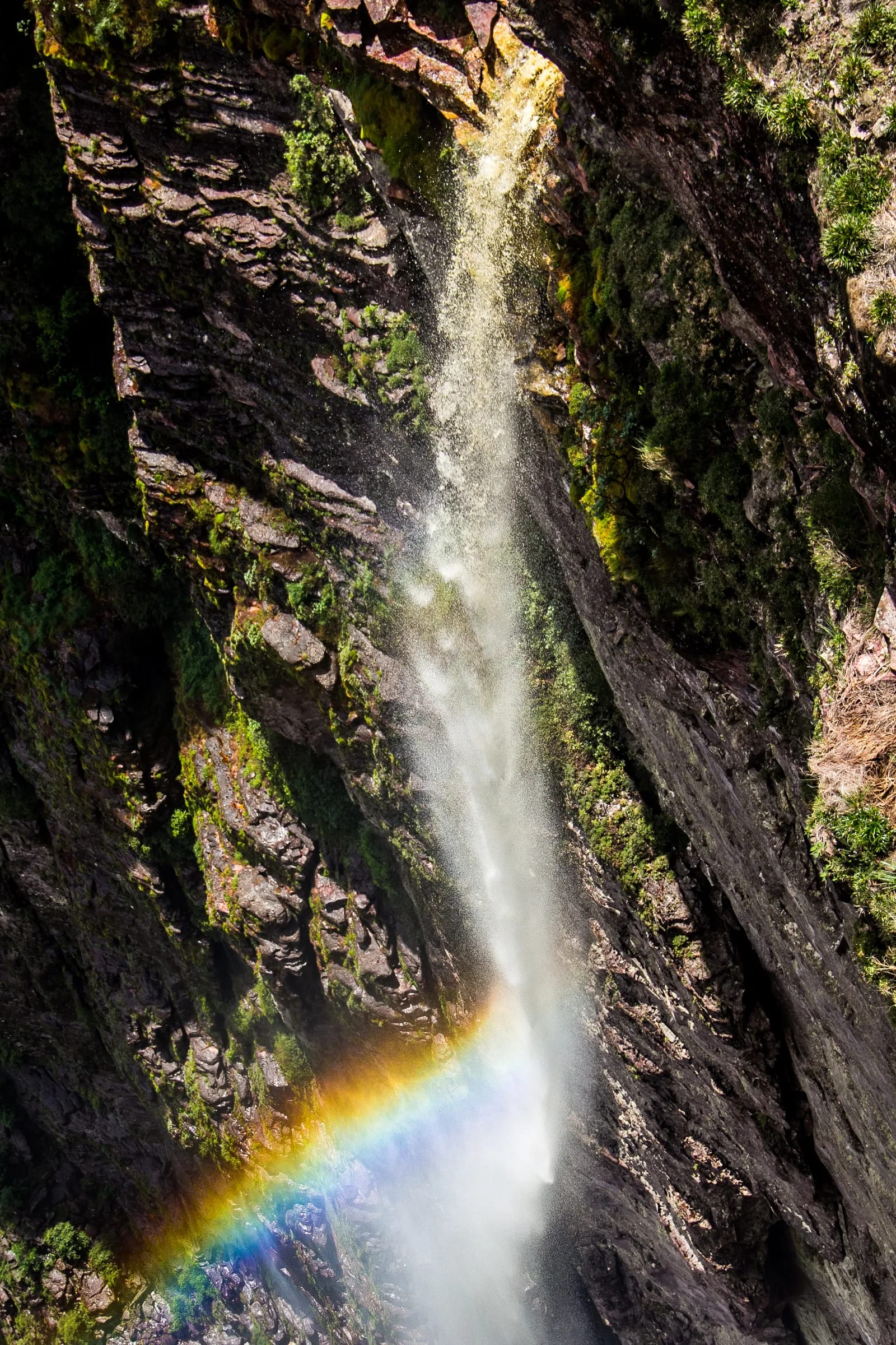
Cachoeira da Fumaça do Cerrado
Cachoeira da Fumaça
In the Estação Ecológica Serra Geral do Tocantins, within the area encompassing Almas and Ponte Alta do Tocantins.
Cachoeira da Fumaça do Cerrado is a protected waterfall within the Estação Ecológica Serra Geral do Tocantins. Its landscape brings together water, escarpments, and Cerrado formations, but access should not be treated as an unrestricted tourist visit.
Recognized by the Municipality of Almas as Cachoeira da Fumaça, the waterfall belongs to a federal Estação Ecológica — a protected area dedicated to nature conservation and scientific research. There, veredas — water-fed Cerrado wetlands —, wet grasslands, savanna formations, and the contours of Serra Geral combine in a landscape of striking natural power. ICMBio's management plan specifically identifies the waterfall as a significant geomorphological feature and limits visits to educational purposes led by the unit.
🤔 Why does it matter?
The interest of this place begins before the photograph: it reveals why a waterfall can be both landscape and conservation heritage. Fumaça lies within a territory that safeguards springs, threatened species, and ecosystems characteristic of the Jalapão Cerrado.
📍 What to see
- The Cachoeira da Fumaça waterfall, when included in an authorized activity
- Escarpments and other geomorphological features of Serra Geral
- Veredas and wet grasslands associated with the Cerrado
- Open vegetation types of the biome and savanna landscapes
🎒 Things to do
- Confirm in advance whether the unit is conducting an educational activity
- Take part in the environmental interpretation planned for the authorized group
- Observe the landscape without removing natural elements
- Take photographs only in accordance with the guidance received
✨ Recommended experiences
- For schools and educational groups: arrange an educational activity in advance with the Ecological Station's management, and use the waterfall to read the water, terrain, and Cerrado.
- For researchers: combine the visit with the authorization procedures applicable to research in a federal conservation unit.
- For independent travelers: turn curiosity about the attraction into responsible planning by checking whether a visit is legally possible before mapping out an itinerary.
🍽️ Local cuisine
🎶 Soundtrack
- Joia do Cerrado — Juraildes da Cruz
🎭 Local culture
🌿 Nature nearby
🌎 Biomes
🏞️ Natural features
🐾 Possible animals in the area
🌱 Possible plants in the area
📅 Best time to visit
There is no official tourist season published for Cachoeira da Fumaça; the appropriate opportunity is one provided for in an educational activity authorized by the Ecological Station's management.
- ✅ Best time:
- According to the schedule and formal authorization for the educational or research activity.
- 🟡 Shoulder season:
- Not applicable without an authorized program.
- 🔴 Less recommended:
- Any date without authorization or incompatible with the conditions set by the unit's management.
- 📝 Notes:
- The original record suggested months of higher flow, but no official visitation program was found that would allow them to be turned into a public travel recommendation.
🧭 Getting there
🏙️ Base city: Rio da Conceição, the Ecological Station's administrative headquarters; Almas and Ponte Alta do Tocantins are territorial reference points in the surrounding area.
✈️ Airport: Palmas Airport – Brigadeiro Lysias Rodrigues
- Go to the region only after confirming with the Ecological Station's management whether an educational activity or applicable authorization is possible.
- Use the unit's headquarters in Rio da Conceição as the institutional reference point for up-to-date access information.
- Do not treat the reference coordinate as an independent navigation instruction or as permission to enter.
🚗 Local transportation
- Travel to the waterfall depends on the rules, itinerary, and guidance defined for the authorized activity.
- No permanent public route, official trail signage, or road conditions for independent visitation have been confirmed.
ℹ️ Practical information
- 🏗️ Infraestrutura:
- No confirmed public visitor infrastructure at the attraction
- 🏨 Hospedagem:
- No lodging is officially listed at the waterfall; urban services in the surrounding area should be checked directly before the trip.
- 🍴 Diet:
- No food service has been officially confirmed on site.
- 🧭 Guides and agencies:
- The institutional reference is the Ecological Station's management, as educational visitation must be led by the unit in accordance with its management plan.
- 📶 Internet and signal:
- No specific official information is available; plan communications before leaving urban areas.
- 💰 Estimated cost:
- No official price for admission, day-use access, or tourist activity has been published.
- 📝 Notes:
- Opening hours, entrance fees, rappelling operations, permitted swimming areas, marked pools, and visitor facilities have not been confirmed.
♿ Acessibilidade
Level: consult local operators
No official description was found of an accessible route, mobility support, adapted restrooms, or other accessibility infrastructure at the waterfall.
- Request practical information from the unit's management in advance before arranging any travel.
- Do not assume that natural terrain, watercourse banks, or viewing areas have mobility adaptations.
⚠️ Safety
🚨 Real risks
- Unauthorized entry into a strict-protection conservation unit
- Uneven natural terrain and potentially slippery rocks
- Changing water and weather conditions
- Limited communications outside support towns
✅ Recommended care
- Obtain guidance and authorization from management before traveling.
- Follow the itinerary, boundaries, and instructions of the led activity in full.
- Bring water, sun protection, footwear with good traction, and personal items suited to the natural environment.
- Do not enter the water, approach edges, or undertake vertical techniques without permission and qualified guidance.
⛔ When to avoid: Whenever there is no authorization, management advises against the activity, or environmental conditions are not considered safe.
📝 Checklist — what to bring
- Proof or confirmation of the relevant authorization
- Enough water for the duration of the activity
- Hat, sunglasses, and sunscreen
- Closed-toe footwear with good traction
- Insect repellent
- A light snack and a container to carry out your own waste
- Personal first-aid kit
✈️ Travel tips
- Plan the trip as a conservation activity, not as an open-access swimming spot.
- Contact the unit's management before buying transportation, booking lodging, or arranging any service.
- Respect the educational purpose and the fragility of veredas, wet grasslands, and watercourse banks.
- Keep a safe distance from the waterfall and leave no waste in the environment.
💡 Curiosidades
- The Ecological Station's management plan lists the Fumaça and Fumacinha waterfalls side by side as significant geomorphological features.
- The conservation unit that contains the attraction covers 707,078.75 hectares (1,747,227 acres).
- The Ecological Station protects springs connected to both the Araguaia-Tocantins Basin and the São Francisco Basin.
🤔 Did you know?
- At an Ecological Station, the general rule is not open tourism: visits depend on an educational purpose and the unit's specific rules.
- Among the species that motivate protection of the region is the Brazilian merganser, a bird that is critically endangered.
- The buriti, a palm associated with the Cerrado's wet areas, is among the species valued in the unit's planning.
📜 History and context
The Estação Ecológica Serra Geral do Tocantins was established in 2001 to preserve samples of Cerrado ecosystems and support scientific research. Its management plan, approved in 2014, includes Cachoeira da Fumaça among the geomorphological features whose integrity must be maintained. The unit encompasses municipalities in Tocantins, including Almas and Ponte Alta do Tocantins, as well as Formosa do Rio Preto in Bahia.
🌍 Global importance
The waterfall takes on broader significance because it belongs to the Mosaico do Jalapão, a group of protected areas that safeguards one of Brazil's vast continuous stretches of Cerrado under strict protection. It is a landscape element linked to the conservation of water resources, biological diversity, and scientific knowledge in a savanna of continental importance.
🗺️ Quick map (orientation)
📌 Main base: Headquarters of the Estação Ecológica Serra Geral do Tocantins, in Rio da Conceição.
🧭 Landmarks
📍 Nearby places
Pequenas descobertas
- Tocantins
- A municipality in southeastern Tocantins; a gateway to waterfalls and Cerrado veredas.
- Quartzito
- A hard metamorphic rock, often light-colored, found in the region's rock formations.
- Veredas
- Waterlogged Cerrado areas fed by shallow groundwater; they shelter buriti palms and water-associated fauna.
- Buriti
- A palm typical of wet areas in the Cerrado; its fruit is used in sweets, ice cream, and creams.
- Rapel
- A controlled descent by rope down rock faces or waterfalls, using specialized equipment.
- Pequi
- A fragrant Cerrado fruit widely used in rice dishes and stews.
- Paçoca de pilão
- Pounded dried beef with cassava flour; an energy-rich food of the sertão.
- PMW
- The IATA code for Palmas Airport, Tocantins' main air gateway.
- BR-153/010
- A federal highway corridor cited in the original record as a connection between Palmas and the state's southeast.
- TO-280
- A state highway in southeastern Tocantins linking Natividade and Almas; local conditions should be checked.
- Local
- Service prices vary by season and group size.
- Moderada
- A route with elevation changes, natural steps, and stretches of rock slab; it may not be suitable for wheelchairs without dedicated support.
- Estruturas dedicadas
- A set of adaptations such as ramps, continuous handrails, tactile flooring, and adapted restrooms.
Keep discovering
Culture