.webp&w=1920&q=82)
.webp&w=1920&q=82)
.webp&w=1920&q=82)
.webp&w=1920&q=82)
.webp&w=1920&q=82)
.webp&w=1920&q=82)
.webp&w=1920&q=82)
.webp&w=1920&q=82)
.webp&w=1920&q=82)
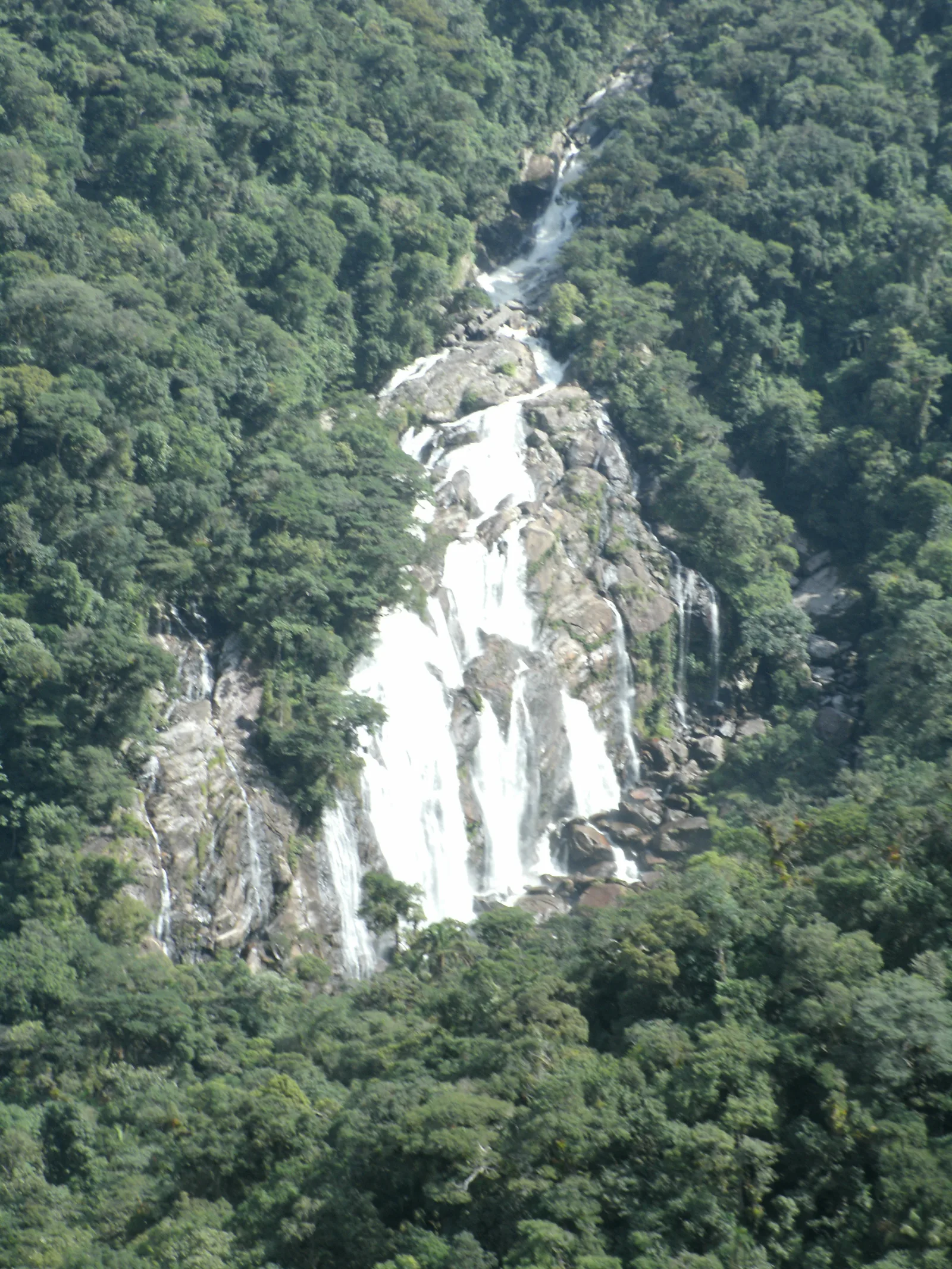
Cachoeira do Elefante
In the Parque Estadual da Serra do Mar, Núcleo Bertioga, within the Rio Itapanhaú trail complex on the coast of São Paulo state.
A guided passage through the Atlantic Forest of the Serra do Mar leads to Cachoeira do Elefante, the large waterfall in the Rio Itapanhaú complex. It is a demanding outing, requiring advance booking and a mandatory guide.
The route descends the escarpments of the Serra do Mar through dense forest to Cachoeira do Elefante, presented by Bertioga’s tourism authorities as the region’s largest waterfall. It covers about 2.5 km (1.6 mi) and takes four hours, with an assisted crossing of the Itapanhaú River and sections over natural terrain. The walk also passes through an area associated with the old Rota do Comércio, a historic link between the highlands and the coastal plain.
🤔 Why does it matter?
More than a waterfall swim, the visit reveals how protecting the valley keeps water, forest, and landscape connected on the coast of São Paulo state. The requirement for a guide turns the physical challenge into an experience of attentive reading of the Serra do Mar.
📍 What to see
- The large drop of Cachoeira do Elefante
- Cachoeira do Véu da Noiva above the valley
- The meeting of the Guacá and Sertãozinho rivers, where the Itapanhaú begins
- Escarpments cloaked in the dense forest of the Serra do Mar
🎒 Things to do
- Follow the trail with a mandatory guide
- Take part in the anchored crossing of the Itapanhaú River
- Observe the forest and photograph the landscape without leaving the authorized route
- When included in the guided itinerary, return via the Trilha do Vale Verde
✨ Recommended experiences
- Morning of ecotourism: book an early departure, complete the main hike, and take contemplative breaks at the points indicated by the guide.
- Photography itinerary: choose a stable forecast, protect equipment from moisture, and work with the composition of the escarpments before heading back.
- Day of environmental interpretation: pair the walk with questions for the guide about water, forest, and the old connection between the coast and the highlands.
🍽️ Local cuisine
🎭 Local culture
🌿 Nature nearby
🌎 Biomes
🏞️ Natural features
🐾 Possible animals in the area
🌱 Possible plants in the area
📅 Best time to visit
From May to September, when conditions tend to be relatively more stable and the ground less muddy, provided the forecast and operation permit the outing.
- ✅ Best time:
- May to September.
- 🟡 Shoulder season:
- March to April and October to November, with extra attention to rain and river levels.
- 🔴 Less recommended:
- December to February, when the coast typically receives more rain and the chance of cancellation rises.
- 📝 Notes:
- For safety reasons, there are no outings on rainy days. Confirmation of a visit should take account of weather advisories, guide availability, and conditions reported by the park.
🧭 Getting there
🏙️ Base city: Bertioga
✈️ Airport: São Paulo/Congonhas Airport, in São Paulo city.
- Reach Bertioga by road and arrange the visit in advance with an accredited operator.
- Use the Dom Paulo Rolim Loureiro Highway, known as the Mogi-Bertioga Road, as the main approach to the valley.
- Arrange the meeting point directly with the guide, as it is set according to that day’s itinerary.
🚗 Local transportation
- Access to the activity requires booking and a mandatory guide.
- The official schedule runs daily from 6:00 a.m. to noon, subject to availability.
- Follow the guiding team’s instructions for the final transfer to the start of the route.
ℹ️ Practical information
- 🏗️ Infraestrutura:
- Organized support at the trailhead and rustic infrastructure along the route.
- 🏨 Hospedagem:
- Plan to stay in Bertioga; there is no overnight stay associated with the trail.
- 🍴 Diet:
- Bring water and a snack for the hike, and arrange meals in the base city.
- 🧭 Guides and agencies:
- A guide is mandatory and must be arranged with an association or accredited guide from Núcleo Bertioga.
- 📶 Internet and signal:
- Do not rely on stable signal along the route; download maps and contacts before leaving.
- 💰 Estimated cost:
- The guiding fee was not published in the official sources consulted. Ask the operator for the current price before booking.
- 📝 Notes:
- The official itinerary page states a capacity of up to 50 people per time slot, with reservations subject to availability.
♿ Acessibilidade
Level: not accessible for people with reduced mobility
The route includes descending escarpments, natural unevenness, and an assisted river crossing; no official information indicates an adapted route to the waterfall.
- Assess your fitness, balance, and independence before booking.
- Report any specific needs to the operator in advance.
- If you have a significant health condition, do not substitute a professional assessment with a tourism description.
⚠️ Safety
🚨 Real risks
- Rising river levels during rain
- Slippery rock slabs and ground
- A crossing section with an anchor line
- Effort consistent with a trail rated difficult
✅ Recommended care
- Follow the guide’s instructions and posted signs.
- Wear closed-toe footwear with grippy soles.
- Bring a rain jacket, water, insect repellent, and sun protection.
- Carry out all waste until you reach an appropriate disposal point.
⛔ When to avoid: Avoid visiting on rainy days, during weather alerts, or whenever the responsible team suspends operations.
📝 Checklist — what to bring
- Closed hiking footwear with grippy soles
- Water and a light snack
- Rain jacket
- Sunscreen and insect repellent
- Cap or hat
- Bag for carrying waste
- Waterproof protection for a phone and camera
✈️ Travel tips
- Book the activity ahead of time, as group size is limited.
- Allow enough time to meet the schedule set by the guide.
- Check the forecast and weather advisories the evening before and on the morning of the visit.
- Do not plan another demanding activity for the same day.
💡 Curiosidades
- The itinerary can return by the same route or, depending on the authorized guiding plan, continue along the Trilha do Vale Verde toward the Parque Estadual Restinga de Bertioga.
- Cachoeira do Véu da Noiva can be seen from the lookout at kilometer 86 of the Mogi-Bertioga Highway when visibility is favorable.
- The visitor complex limits groups to 50 people per time slot.
🤔 Did you know?
- The route is presented as the most traditional trail in the Rio Itapanhaú trail complex.
- The river crossing requires an anchor line installed by the guides during the activity.
- Together with the Parque Estadual Restinga de Bertioga, Núcleo Bertioga forms a corridor between land and marine-coastal environments.
📜 History and context
The trail crosses an area associated with the Rota do Comércio of the colonial period, used to connect the Baixada Santista and the highlands. The present-day Núcleo Bertioga was created in 2010 during the expansion of the Parque Estadual da Serra do Mar and encompasses parts of Bertioga and Biritiba Mirim.
🌍 Global importance
No formal international recognition for the waterfall on its own was identified in the research. Its broader importance lies in its inclusion in a protected stretch of coastal Atlantic Forest, a biome prioritized for conservation and for sustaining ecosystem services in the Baixada Santista.
🗺️ Quick map (orientation)
📌 Main base: Bertioga, on the coast of São Paulo state.
🧭 Landmarks
📍 Nearby places
Pequenas descobertas
- SP
- Abbreviation for the state of São Paulo.
- Rio Itapanhaú
- A coastal river in São Paulo state formed by the confluence of the Guacá and Sertãozinho rivers.
- Caiçara
- A reference to traditional communities and practices along the southeastern and southern coast, with Indigenous, Portuguese, and African heritage.
- Autorizados
- Use of water permitted only in areas considered safe and marked by the guiding team.
- Monitoria obrigatória
- The requirement to be accompanied by an accredited guide or environmental monitor in order to undertake the activity.
- Cambuci
- A fragrant, citrusy fruit of the cambucizeiro tree, associated with the Serra do Mar.
- Caldeirada
- A stew made with fresh fish, tomato, bell pepper, and herbs.
- Banana flambada
- A traditional caramelized banana sweet from areas of the Baixada Santista.
- PESM
- Parque Estadual da Serra do Mar, a state conservation unit.
- Monitor credenciado
- A professional registered or authorized to lead environmental activities in the conservation unit.
- Itapanhaú
- A river crossing undertaken with safety equipment and under the direction of the authorized team.
- Rústica
- A path over uneven terrain, with roots, ascents, descents, and a river crossing.