.webp&w=1920&q=82)
.webp&w=1920&q=82)
.webp&w=1920&q=82)
.webp&w=1920&q=82)
.webp&w=1920&q=82)
.webp&w=1920&q=82)
.webp&w=1920&q=82)
.webp&w=1920&q=82)
.webp&w=1920&q=82)
Cachoeira do Itambé
On the boundary between Cássia dos Coqueiros and Mococa, in northeastern São Paulo state, reached via Sebastião Félix Viana Municipal Road in Cássia dos Coqueiros.
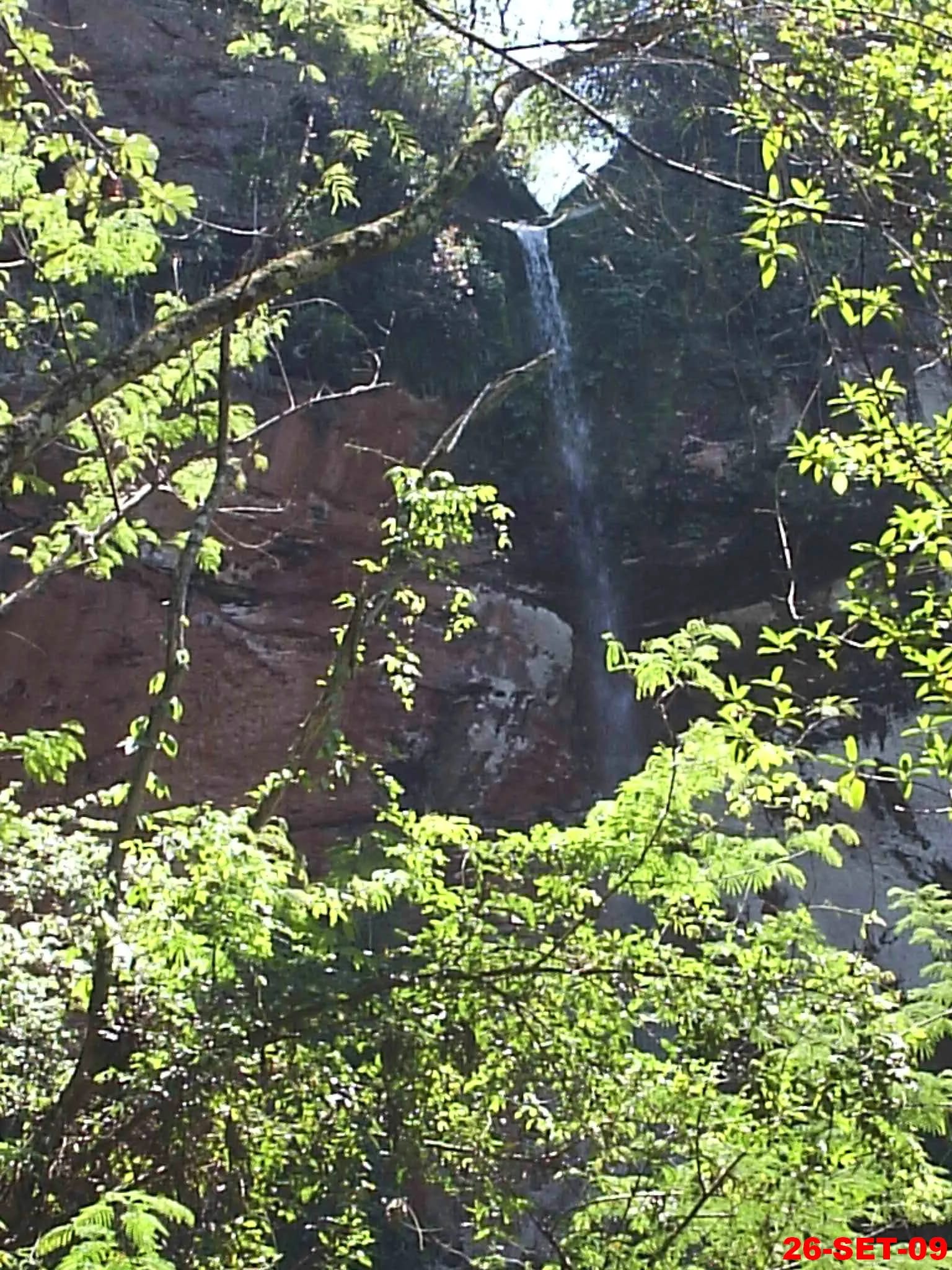
An approximately 85-meter (279-ft) waterfall in a valley of São Paulo’s interior, where a view from above gives way to the adventure of a steep descent to the pool.
On the boundary between Cássia dos Coqueiros and Mococa, Cachoeira do Itambé cuts through a forested, rocky valley before dropping into a pool at its base. The visit begins above, where simple visitor facilities await, then shifts pace on the steep trail, fitted with hand ropes. It is an inland landscape of silence, running water, and caipira hospitality.
🤔 Why does it matter?
Itambé is Cássia dos Coqueiros’ best-known natural attraction and distills the region’s waterfall tourism: beauty reached by rural road, basic infrastructure, and an experience that demands attention to the terrain. Its appeal lies as much in the force of the drop as in its invitation to discover a less familiar side of São Paulo’s interior.
📍 What to see
- The sheet of water against the valley’s rock face
- The panoramic view from the top
- The pool at the waterfall’s base
- The forest and vegetation that accompany the watercourse
🎒 Things to do
- Follow the steep trail down to the lower area with care
- Use the lookout point to take in the relief and photograph it
- Enter the water only when conditions, signage, and local management allow it
- Rest or picnic in the upper area, respecting the rules of the place
- Watch birds and listen to the forest without feeding wildlife
✨ Recommended experiences
- Half-day discovery: arrive in the morning, take in the upper view, and descend only if the trail surface is safe for your group.
- Photography itinerary: favor the soft early light, frame the waterfall from above, and protect equipment from moisture.
- A slow-paced nature outing: pair the view with a snack break and return before the weather changes.
- Regional outing: make the waterfall the day’s centerpiece, then add Cássia dos Coqueiros’ or Mococa’s rural attractions.
🍽️ Local cuisine
🎶 Soundtrack
- Pagode em Brasília — Tião Carreiro & Pardinho
- Tristeza do Jeca — Tonico & Tinoco
🎭 Local culture
🌿 Nature nearby
🌎 Biomes
🏞️ Natural features
🐾 Possible animals in the area
🌱 Possible plants in the area
📅 Best time to visit
From May to August, the drier season tends to offer firmer ground and cleaner visibility; the final decision should consider rain from previous days.
- ✅ Best time:
- May through August, when the source listing indicates drier conditions and a firmer trail.
- 🟡 Shoulder season:
- March and April, as well as September and October—transition months that call for extra attention to the ground and current.
- 🔴 Less recommended:
- Days of heavy rain, especially in the wettest period of the year.
- 📝 Notes:
- The flow, the safety of the descent and the possibility of bathing vary with the weather conditions and with the guidelines of the property.
🧭 Getting there
🏙️ Base city: Cássia dos Coqueiros
✈️ Airport: Dr. Leite Lopes State Airport, Ribeirão Preto
- From Cássia dos Coqueiros, follow Sebastião Félix Viana Municipal Road to km 3 (mile 1.9), as listed in the operator’s public address.
- The entrance is on private property; confirm in advance whether visits are possible on your preferred date.
- For those who come from outside the region, commuting by private car is the most practical alternative.
🚗 Local transportation
- Access to the top is by rural road and private vehicle or combined transport is usually necessary.
- From the upper area, reach the pool on foot over steep ground, using hand ropes for support.
- Avoid relying on public transportation to arrive and return on the same day.
ℹ️ Practical information
- 🏗️ Infraestrutura:
- Basic
- 🏨 Hospedagem:
- Look for lodging in Cássia dos Coqueiros, Mococa, or other towns in the region; the source listing did not establish that accommodation is available at the attraction.
- 🍴 Diet:
- Turismo de Mococa reports a bar at the top of the waterfall; the operator’s public page also presents the site as a leisure area with a snack bar. Confirm what is available on the day of your visit.
- 🧭 Guides and agencies:
- No public listing for a guide dedicated exclusively to the waterfall was found. Confirm any booking with local operators or the property’s management.
- 📶 Internet and signal:
- No reliable coverage information is available. Download maps and let someone know your itinerary before leaving the urban area.
- 💰 Estimated cost:
- The operator’s public profile listed an entrance fee of R$25 per person per day at the most recent check; parking, guide, and other fees were not confirmed.
- 📝 Notes:
- Facilities are concentrated at the top, while the area at the base remains rustic. Hours, rates, and services may change without notice on official channels.
♿ Acessibilidade
Level: consult local operators
The municipal source confirms that the trail to the pool is steep and fitted with hand ropes. No assessment or accessible-route information was found for people with reduced mobility.
- Do not assume that the parking area, lookout point, or bar has accessibility features without confirming first.
- The descent to the pool is not suitable for wheelchairs or for anyone unable to negotiate uneven changes in level.
- Contact management to evaluate alternatives for staying in the upper part.
⚠️ Safety
🚨 Real risks
- Slippery footing and a steep trail
- Falls on sections fitted with hand ropes
- Increased flow after rain
- Wet rocks beside the pool
- Sun exposure and dehydration in the open area
✅ Recommended care
- Wear closed footwear with grippy soles.
- Do not go down if there is rain, threat of thunderstorm or contrary guidance from management.
- Keep clear of the falling water and do not enter areas where the bottom is not visible.
- Bring water, a snack, and sun protection; leave no waste.
- Do not use the ropes as a toy and keep a safe distance between the group members.
⛔ When to avoid: Avoid the descent in rain, immediately after storms, when the trail is very muddy, under a local warning, or if you are not confident on steep terrain.
📝 Checklist — what to bring
- Closed hiking shoes or sneakers with non-slip soles
- Sufficient water for the entire visit period
- Sunscreen, hat and sunglasses with UV protection
- Light snack and bag to bring your own trash
- Light raincoat and change of clothes
- Dry bag or protection for phone and documents
✈️ Travel tips
- Plan at least half a day to enjoy the high part and decide calmly if the descent is suitable for your group.
- Leave early to take advantage of milder temperatures and reserve room for return with natural light.
- Confirm opening, entrance procedures, payment method, and road conditions before setting out.
- Respect the site’s private character, its signage, and the boundaries of open areas.
- Do not rely on continuous mobile service in the countryside.
💡 Curiosidades
- The two municipal portals consulted give different figures for the drop: Mococa reports 84 meters (276 ft), while Cássia dos Coqueiros reports 86 meters (282 ft); this listing therefore uses approximately 85 meters (279 ft).
- The descent described by Mococa Tourism measures approximately 100 meters (328 ft) and uses ropes as handholds.
- The upper facilities include parking, barbecue grills, and a bar, while the poolside area remains rustic.
🤔 Did you know?
- Cássia dos Coqueiros City Hall reports that the municipality has about 20 waterfalls, 13 of them with a substantial drop and a pool suitable for swimming.
- City Hall itself presents Itambé as the municipality’s most famous waterfall.
- The path to the attraction begins very close to the city, but the experience changes completely when you reach the rural valley.
📜 History and context
Waterfalls have become one of Cássia dos Coqueiros’ main tourism strengths. Itambé, on a farm with controlled access along the Mococa boundary, has emerged as the best-known reference within this group of rural landscapes. The visit retains the character of a nearby escape, organized around the property and its support facilities.
🌍 Global importance
No international heritage designation, national park or equivalent recognition was identified for the site. Its relevance is regional: the waterfall helps to show how small municipalities in the Brazilian countryside can structure experiences of nature outside the large tourist circuits.
🗺️ Quick map (orientation)
📌 Main base: Cássia dos Coqueiros
🧭 Landmarks
📍 Nearby places
Pequenas descobertas
- Mogiana
- Subregion of Mogiana Paulista, known for hills, coffee plantations and mild climate.
- Corrimão de cordas
- Ropes attached along sloping stretches serve as handholds.
- Caldo de cana
- Pressed sugarcane juice, served chilled.
- Cachaça de alambique
- Artisanal cachaça—Brazil’s sugarcane spirit—produced in Mogiana’s copper pot stills.
- RAO
- IATA code of Dr. Leite Lopes State Airport, in Ribeirão Preto.
- Camping do Zé Manso
- Access point used by visitors; confirm rules and times before you go.
- Trilha ao poço
- Sharp slope, uneven steps and stretches with support rope.
- Cordas
- Fixed ropes for hand support.
- Serra da região
- Highland zone between São Paulo and Minas Gerais, with canyons and rocky outcrops.
- Pedra aflorada
- From the Tupi ita, “stone,” and ambe, “outcropped”: roughly, an outcropped stone or cliff.
Keep discovering
Culture