Vale da Lua
In the rural area of Alto Paraíso de Goiás, off GO-239, between the town and Vila de São Jorge, near Chapada dos Veadeiros National Park.
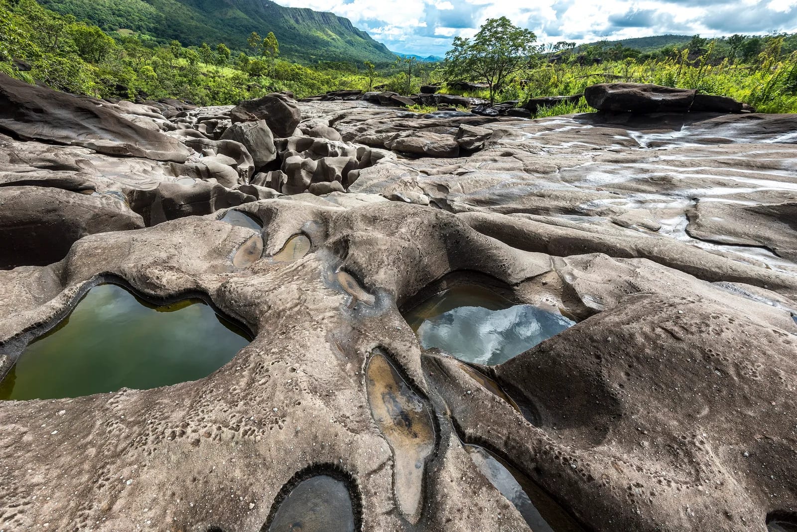
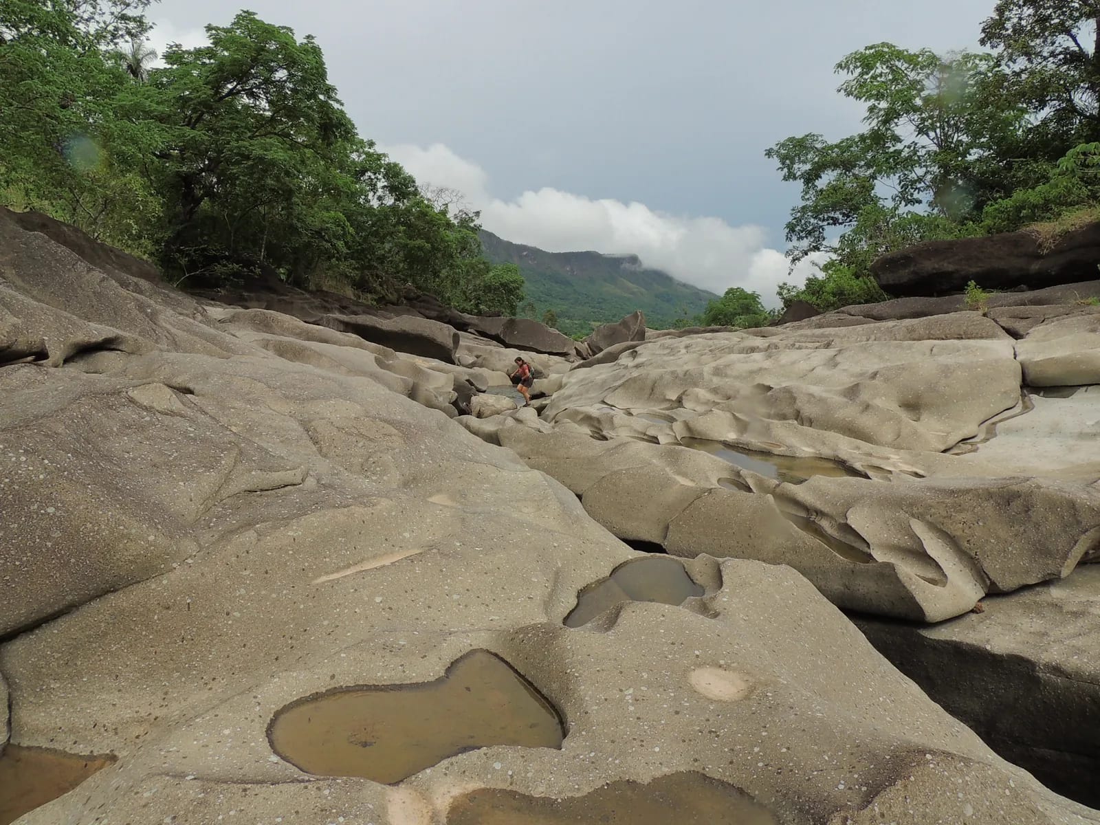
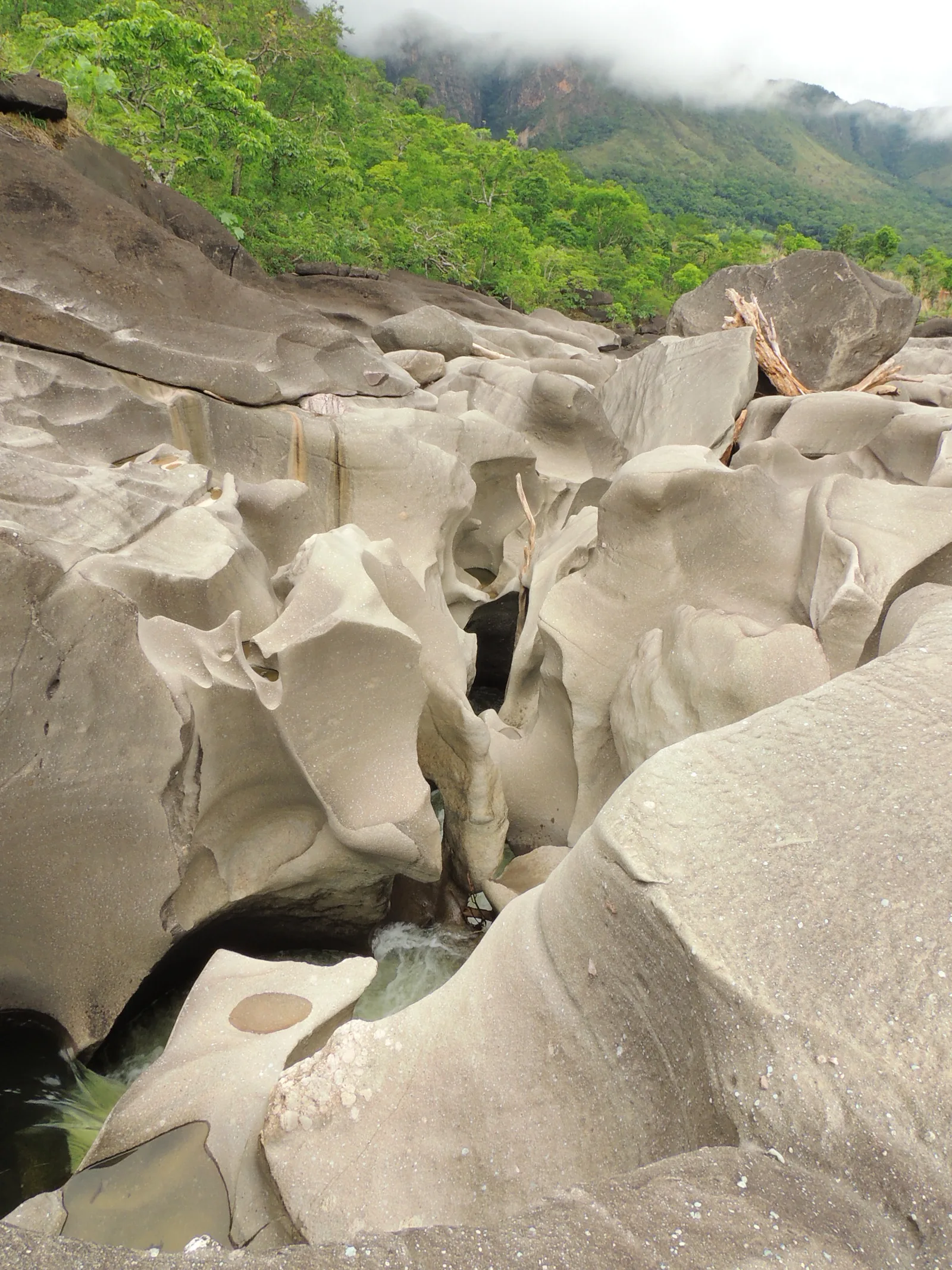
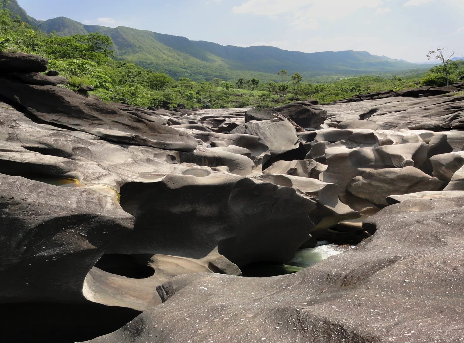
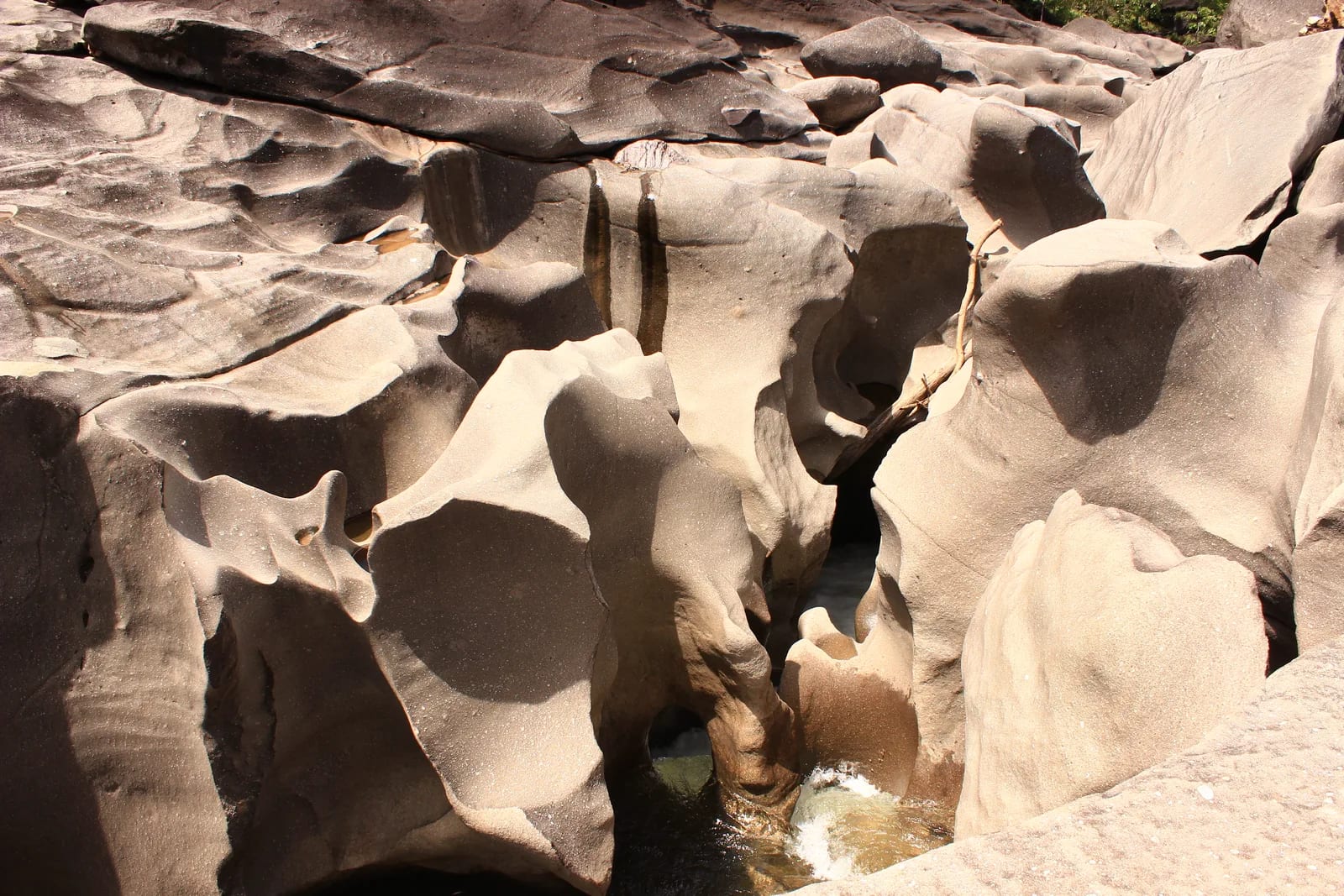
In Chapada dos Veadeiros, the São Miguel River carves grooves, hollows, and curved surfaces that seem to belong to a lunar landscape. Vale da Lua brings together a short walk, swimming pools, and an immediate reading of Cerrado geology.
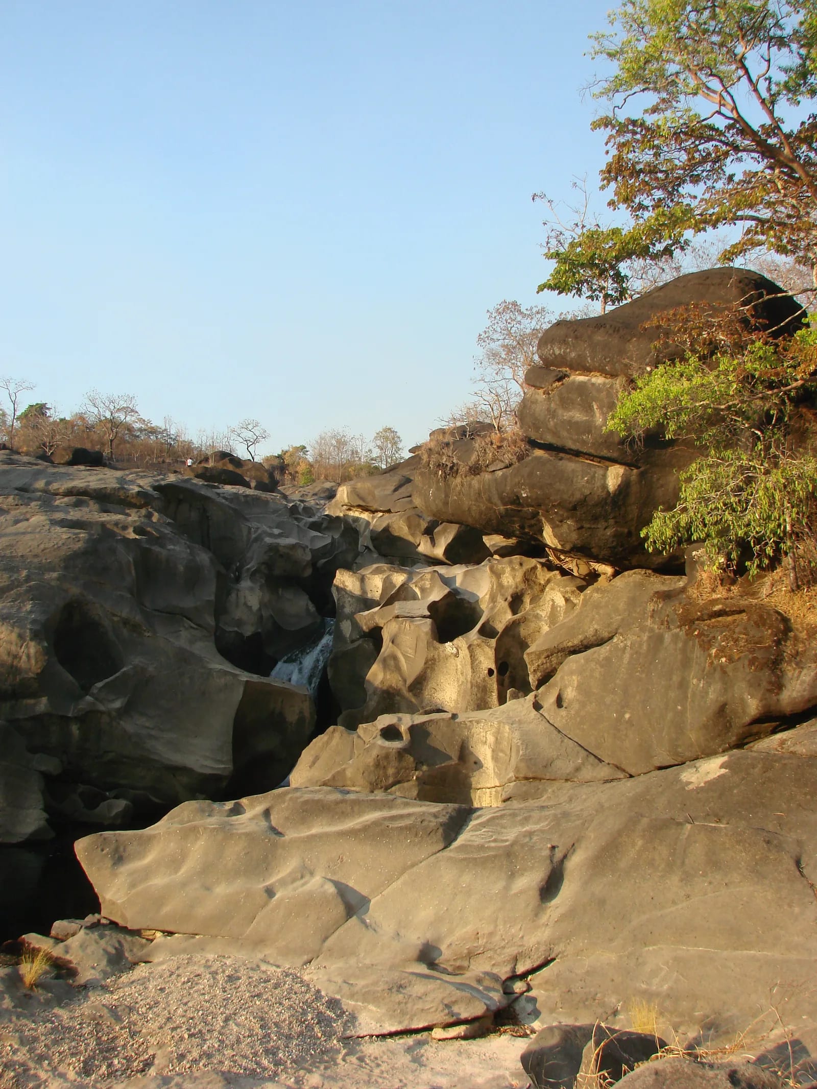
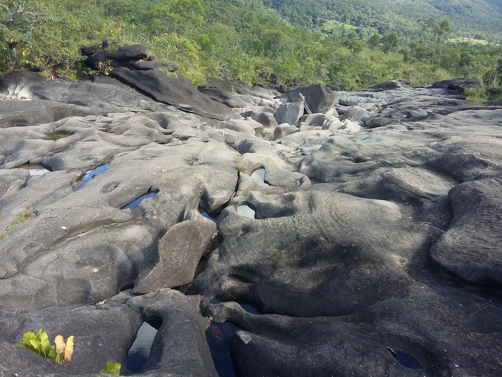
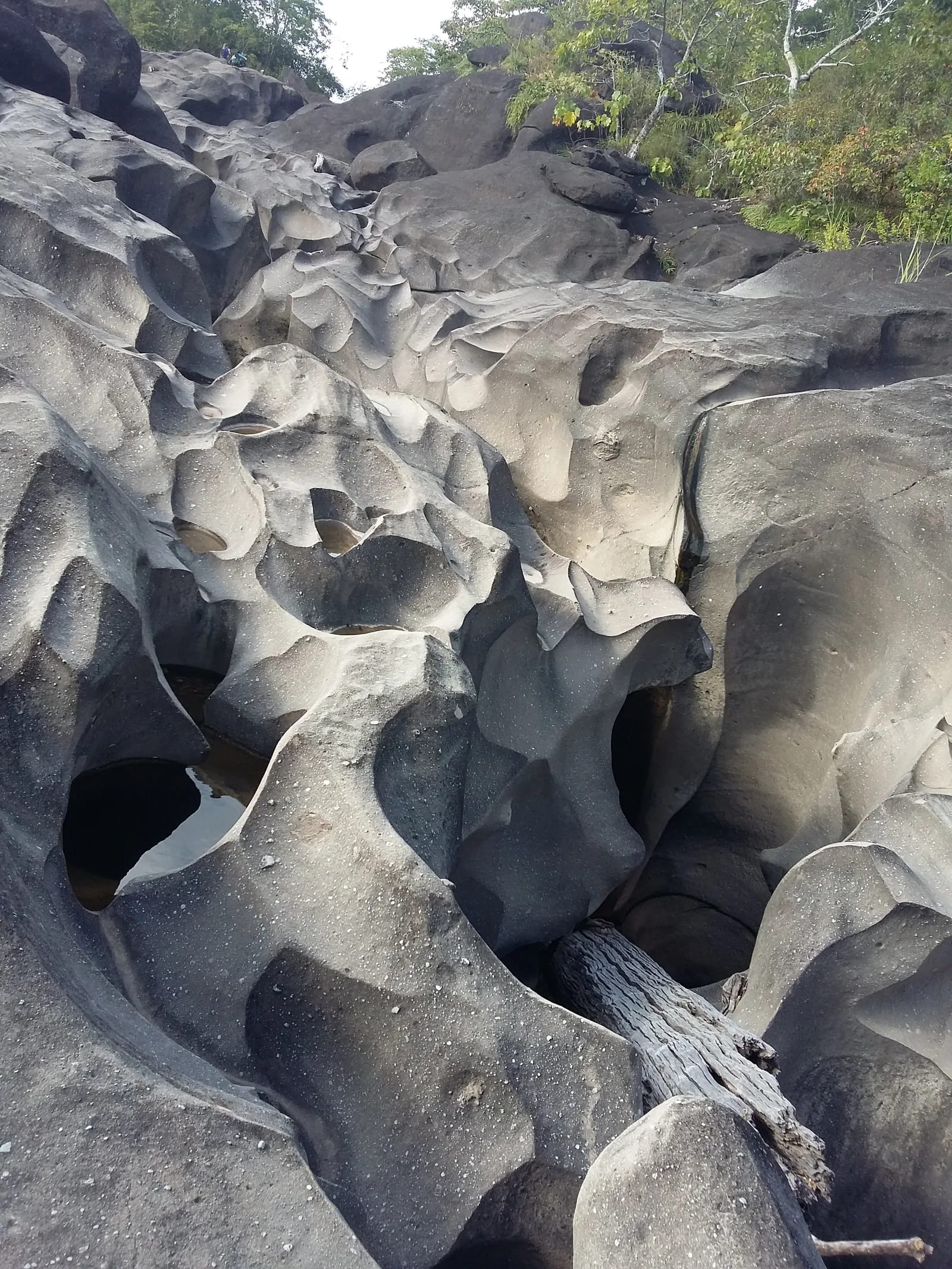
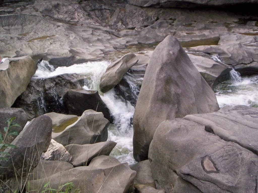
Vale da Lua reveals the São Miguel paraconglomerate, a rock water has shaped into recesses, potholes, and polished slabs. The result is a riverbed of undulating forms, with stretches of rapids, natural pools, and photographic framings that explain the site’s standing among Chapada’s most striking landscapes.
🤔 Why does it matter?
Few outings offer such a close view of how the water’s ceaseless work transforms rock into landform. The visit is an accessible gateway to geotourism and helps explain why the Cerrado — Brazil’s savanna — holds landscapes far beyond its grasslands.
📍 What to see
- Rounded hollows, channels, and slabs sculpted into the paraconglomerate
- Confined stretches of the São Miguel River
- Natural pools, small falls, and rapids
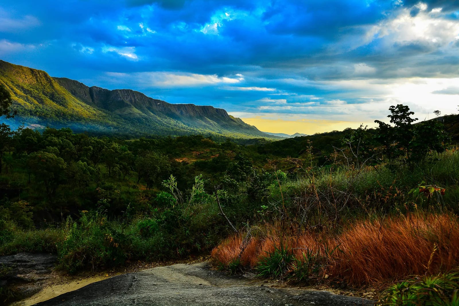
- An open view over the Cerrado terrain
🎒 Things to do
- Follow the access trail rated easy
- Photograph the rocky riverbed’s forms in soft light
- Enter only permitted pools where the current has been assessed
- Observe erosion features without leaving authorized areas
✨ Recommended experiences
- A geotourism morning: arrive at opening time, walk to the riverbed, and set aside time to identify potholes, fractures, and curves in the rock.
- A mindful swimming itinerary: choose an authorized stretch, monitor the river level, and end the activity at the first sign of changing weather.
- A Chapada day: pair the attraction with Vila de São Jorge and other scheduled outings in the area, without trying to fit too many waterfalls into the same period.
🍽️ Local cuisine
🎶 Soundtrack
- Pense em Mim — Leandro & Leonardo
- Pode Chorar — Jorge & Mateus
- Muda de Vida — Zezé Di Camargo & Luciano
🎭 Local culture
🌿 Nature nearby
🌎 Biomes
🏞️ Natural features
🐾 Wildlife you may spot
🌱 Plants you may see
📅 Best time to visit
From May through September, during the dry season, the flow tends to be more predictable and the water is usually clearer. In the rainy season, a visit calls for closer attention to the river level and gatehouse guidance.
- ✅ Best time:
- July to September, when the dry season is most settled.
- 🟡 Shoulder season:
- May and June, the beginning of the dry season, with moderate flow.
- 🔴 Less recommended:
- October to April, the rainy period, with greater hydrological risk.
- 📝 Notes:
- Safe conditions depend on the time of day and the upstream watershed; confirm the situation before entering the pools.
🧭 Getting there
🏙️ Base city: Alto Paraíso de Goiás, with additional support in Vila de São Jorge.
✈️ Airport: Brasília International Airport — Presidente Juscelino Kubitschek
- From Brasília, travel by road to Alto Paraíso de Goiás via the GO-118 and BR-010 connection.
- From Alto Paraíso, take GO-239 toward São Jorge; the municipal portal reports 28 kilometers (17.4 mi) of paved road and 4 kilometers (2.5 mi) of dirt road.
- The entrance is at kilometer 29 (mile 18) of GO-239, in a rural area; continue to the gatehouse by following the signs.
🚗 Local transportation
- A car or hired transfer makes travel between Alto Paraíso, São Jorge, and the attraction’s entrance easier.
- The walk from the gatehouse to the riverbed is short, but the uneven ground requires attention.
ℹ️ Practical information
- 🏗️ Infrastructure:
- Basic at the attraction and more complete in the base towns.
- 🏨 Where to stay:
- Guesthouses, vacation homes, and other accommodations are available in Alto Paraíso de Goiás and Vila de São Jorge.
- 🍴 Food:
- Restaurants, snack bars, and markets are concentrated mainly in Alto Paraíso and São Jorge.
- 🧭 Guides and agencies:
- Alto Paraíso’s Tourism Department maintains a list of accredited guides and operators for services in the area.
- 📶 Internet and signal:
- No official, site-specific information was found on mobile or internet coverage at the riverbed; plan the visit without relying on continuous signal.
- 💰 Estimated cost:
- A R$ 50 visitor fee per person is reported in an update posted by the attraction’s official profile; transportation, food, and lodging should be budgeted separately.
- 📝 Notes:
- The source record reports simple parking, a gatehouse, and basic restrooms. Capacity may be strained on holidays.
♿ Accessibility
Level: consult local operators
The trail is described as easy, but the route to the riverbed includes natural ground, roots, rocks, and wet surfaces. No official information was found that confirms a wheelchair-accessible route.
- Request updated information from the gatehouse before planning a visit with someone with reduced mobility.
- Use a companion’s support at crossings or in rocky areas.
- Do not regard the rocky riverbed as an adapted route.
⚠️ Safety
🚨 Real risks
- Rapid rise in water during heavy rain in the river basin
- Smooth rocks and slippery slabs
- Variable current in pools and rapids
- Sun exposure and dehydration
✅ Recommended care
- Respect closed areas, signs, and the guidance of local staff.
- Leave the riverbed immediately if rain begins, the flow changes suddenly, or the local team issues an alert.
- Do not jump into pools of unknown depth.
- Bring water, sun protection, and footwear with adequate grip.
⛔ When to avoid: Avoid entering the river in rain, with a storm forecast, at high water, or when visitation is closed.
📝 Checklist — what to bring
- Sunscreen and insect repellent
- Hat or cap and sunglasses
- Sneakers or hiking sandals with good grip
- 2–3 liters (0.5–0.8 gal) of water per person
- Dry bag for phone and documents
- Light snack
✈️ Travel tips
- Arrive close to opening time to enjoy softer light and cooler temperatures.
- Set aside two or three days in the region if you want to combine this outing with other Chapada attractions.
- Confirm river conditions at the gatehouse, especially from October through April.
- Bring cash or Pix as an alternative payment method, and reconfirm the fee before you leave.
💡 Fun facts
- The site registered by the Geological Survey of Brazil stands at an elevation of 904 meters (2,966 ft).
- Its entry in the Brazilian Commission on Geological and Paleobiological Sites carries the number 077.
- The geological survey classifies the geosite’s degradation risk as low.
🤔 Did you know?
- The hollows are not craters: they are forms created by weathering, dissolution, and the water’s abrasion of the rock.
- Visitor access is across private land, although the attraction lies near Chapada dos Veadeiros National Park.
- Along the same route, the landscape brings together evidence of sedimentary, metamorphic, structural, and geomorphological processes.
📜 History and context
The popular name arose from the outcrop’s unusual appearance, marked by hollows that recall the surface of the Moon. In the Geological Survey of Brazil’s register, the site is associated with the Brasília Belt and the São Miguel paraconglomerate, whose matrix favors dissolution and the fluvial development of curving features.
🌍 Global importance
The federal geological register assigns international relevance to the geosite and national relevance to its educational and tourism value. The visit also forms part of the regional Cerrado landscape, a biome protected nearby by a group of parks recognized as World Heritage.
🗺️ Quick map (orientation)
📌 Main base: Alto Paraíso de Goiás; Vila de São Jorge is the closest support point to the geosite.
🧭 Landmarks
📍 Nearby places
Small discoveries
- Vila de São Jorge
- A settlement that serves as a base for accessing the park’s trails; its western gateway.
- Goiás
- A Brazilian state: Goiás.
- Quartzito
- A very hard metamorphic rock derived from quartz-rich sandstone.
- Rio São Miguel
- A tributary of the Tocantinzinho River that forms potholes, rapids, and pools.
- Cerrado
- An elevated plain in central Brazil, with savannas and gallery forests.
- Queijo minas/meia-cura
- A fresh cheese typical of Brazil’s Central-West, used in grilled dishes and desserts.
- Doce de leite pastoso
- A creamy milk sweet, cut into cubes; a Goiás classic.
- Araticum
- A fruit typical of the Cerrado, with thick skin and fragrant yellow pulp.
- Cachaça
- Brazil’s sugarcane spirit; Goiás has artisanal labels made in alambiques.
- Tromba-d'água
- A flash flood caused by heavy rain at the headwaters; it raises the river level quickly.
- Lajes escorregadias
- Water-polished surfaces that become extremely slippery.
- BSB
- Brasília International Airport — Presidente Juscelino Kubitschek.
- GO-118/BR-010
- The Brasília–Alto Paraíso connection via GO-118/BR-010.
- GO-239
- The highway leading to Vila de São Jorge, gateway to the park.
- Erosão
- Chemical and physical wear by water that hollows out cavities and grooves.
- Abrasão hídrica
- The friction of waterborne sediments that polishes the rock.